
How ExploreTech Nailed Majuba’s Hidden Copper
"The AI models predicted mineralization... and our team intersected the target zone within just 50 ft of those projections—a remarkable validation of this technology."
- David Greenway, CEO, Giant Mining Corp
Mineral exploration is filled with ups and downs. But every once in a while, there’s a magic moment that makes the rollercoaster worthwhile. The results of hole MHB-36 at Giant Mining Corp’s Majuba project is one of those moments.
On one hand, it’s no surprise to us at ExploreTech that we found copper in MHB-36. After all, our drill-targeting tools, Inverter and Driller, have been drill-tested in the field 7 times - hitting the target every time. We knew there was something between 600-700 feet, but even then, the findings exceeded expectations.
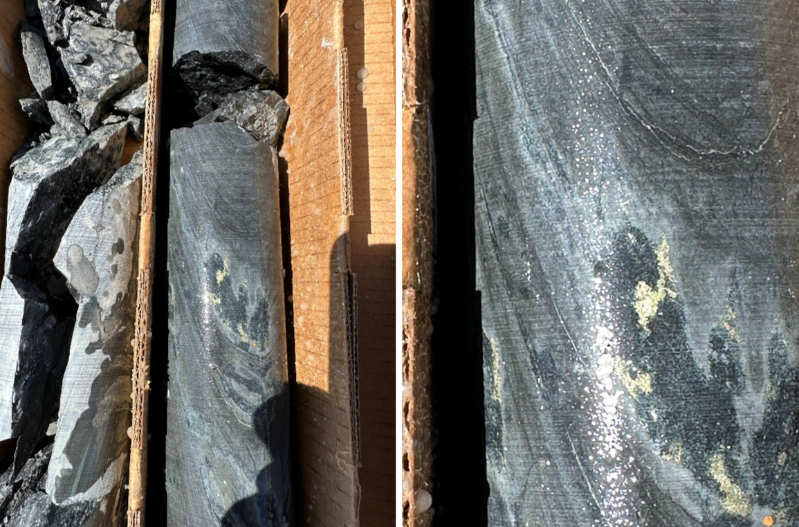
Probabilistic Inversions help projects like Majuba.
MHB-36 was targeted using ExploreTech’s Inverter and Driller APIs. These APIs are really good for finding hidden deposits in geophysics. They ingest geophysics data and quickly generate 3D models with drill targets. The APIs are implemented on ExploreTech’s cloud computing platform, The Engine, which handles the compute orchestration. The advent of cloud computing and AI has made probabilistic algorithms possible for the last 5 years, but commercialization lagged because there was no orchestration layer. The Engine is the first platform that solves this compute orchestration problem, enabling commercial probabilistic computing for the first time ever. Probabilistic algorithms like Inverter are already showing enormous benefits in terms of drilling accuracy and decision timelines. The results at Majuba are just one example.
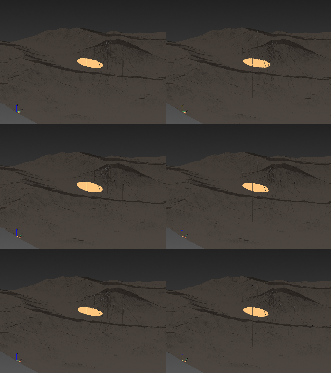
Traditional geophysics is outdated.
Traditional geophysics has barely changed in 70 years. Typically, geophysics data from the field is run through a computing process called an “inversion”. The inversion turns sensor data into a 3D model of the subsurface. But we know that the 3D models from traditional inversions are wrong – leading to expensive drilling misses. The math is well-understood. In the field of inverse problems, it’s called non-uniqueness. In simple terms, geophysics has infinite interpretations, and there’s no way to know what’s right without additional context about the geology. Yet because of computing limitations and conventional thinking, traditional inversions are stuck in the paradigm of giving one best answer. When that one 3D model is drilled, which we know is wrong, the result is too often a million bucks wasted on a dry hole. Now that they are commercially ready, probabilistic techniques like Inverter are the solution.
MHB-36 was preceeded by decades of work.
Before ExploreTech, Giant Mining had drilled 31 holes on the property. Most of the drillholes targeted a breccia zone with known high-grade mineralization near the top of the mountain. Several porphyry intrusive units were known to exist below the breccia zone, but considered a secondary drill target. In their most recent drilling campaign, Giant decided to dedicate one of the 4 planned drillholes, MHB-36, to testing a new target. The MHB-36 target was generated by ExploreTech using Giant's Induced Polarization (IP) geophysics data collected several years ago. This target appeared as a high-conductivity region a several hundred feet from the known breccia zone, and could be reached by a permitted drill pad. The source of the anomaly was predicted to start between 600-700 ft, so we’d have to go through a lot of nothing before testing the target.
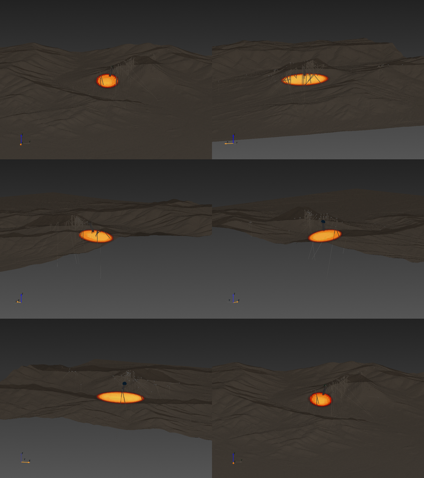
MHB-36: Hitting copper at Majuba.
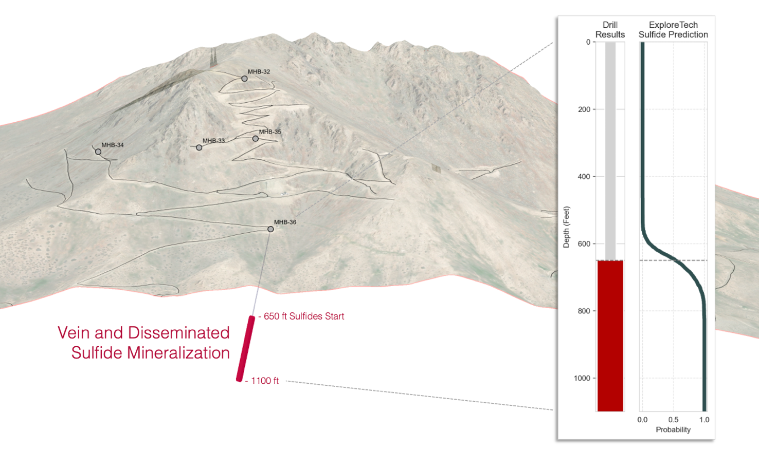
The first 600 feet of drilling were nerve-wracking. The first returns of core were filled with un-mineralized, un-interesting metasediments with no mineralization. There were high stakes in play. At 500 feet, Giant Mining and ExploreTech shared a call on drilling progress, and the drill pressed on. Despite tense expectations, the drill rig kept turning, and at 650 feet, the story changed.
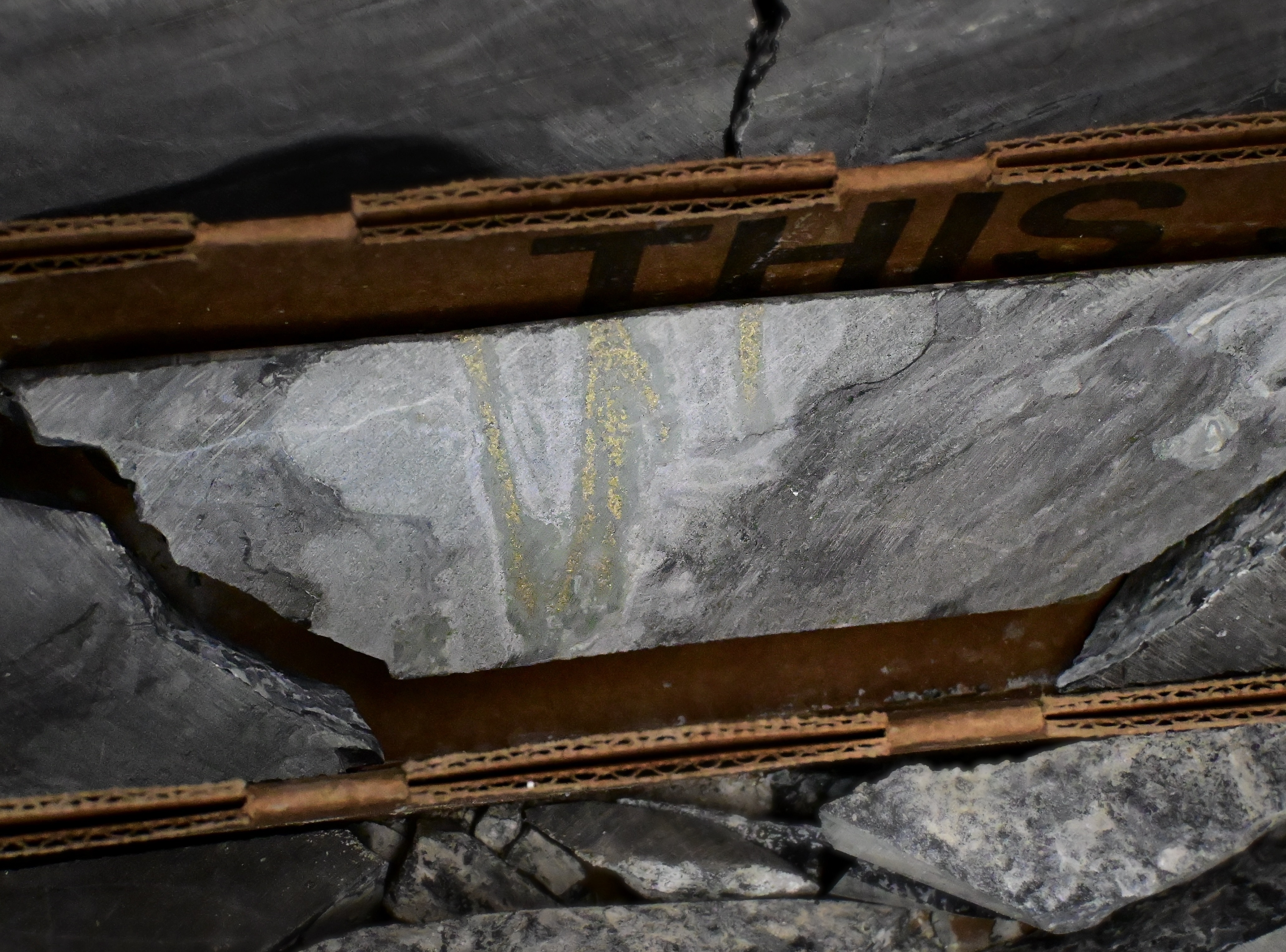
The drill core at 650 feet returned with visible chalcopyrite within the metasediments; something that had never been observed before. As the drilling continued, more copper was found, aligning with our models. The results are still being processed for grade and geological interpretation, but regardless, it’s clear that this finding would not have occurred without ExploreTech’s Inverter technology. And it’s evidence that the copper-bearing system at Majuba is much larger than originally thought, and likely full of more surprises.
Concluding Thoughts
The Majuba case study is a prime illustration of what modern technology can do for exploration. We’ve seen this again and again. Better compute, applied at scale, leads to better decisions and drilling results. And it's just the start. With the right engineering, the same computing principles can be applied to every part of the exploration stack. Mapping, geophysics, geochemistry - all of it will change. The increases in speed and accuracy will change the economics of exploration forever. It's the beginning of a new generation of discoveries.
